Tiedosto:The Diomede Islands in the BeringSea (picture from space).jpg
Siirry navigaatioon
Siirry hakuun
Tämän esikatselun koko: 750 × 600 kuvapistettä. Muut resoluutiot: 300 × 240 kuvapistettä | 600 × 480 kuvapistettä | 900 × 720 kuvapistettä.
Alkuperäinen tiedosto (900 × 720 kuvapistettä, 66 KiB, MIME-tyyppi: image/jpeg)
| Tämä tiedosto on tiedostotietokanta Wikimedia Commonsista. Tiedot kuvaussivulta näkyvät alla. | .jpg?uselang=fi) |
Tiedoston kuvaussivu Commonsissa |
Yhteenveto
| Kuvaus |
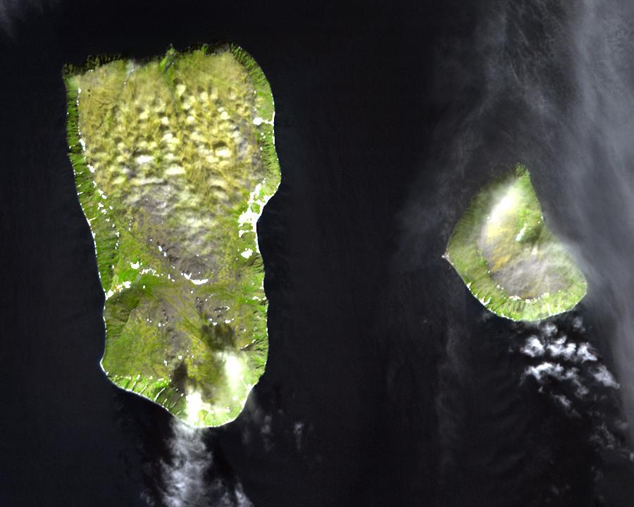
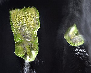
English: Diomede Islands in the middle of the Bering Strait:. The islands are separated by the border between Russia and the USA and by the International Date Line.
|
| Päiväys | |
| Lähde |
|
| Tekijä | Tuntematon |
| Käyttöoikeus (Tämän tiedoston uudelleenkäyttö) |
This file is in the public domain because it was created by NASA. NASA copyright policy states that "NASA material is not protected by copyright unless noted". (NASA copyright policy page or JPL Image Use Policy). This image does not contain a NASA logo. |
Lisenssi
| Tämä teos on ilman tekijänoikeuden suojaa, koska National Aeronautics and Space Administration (NASA) loi sen. Koska Nasa on Yhdysvaltain liittovaltion organisaatio, sen luomat teokset ovat ilman tekijänoikeuden suojaa. ([1][2]) | ||
 |
Varoitukset:
|
Tiedoston historia
Päiväystä napsauttamalla näet, millainen tiedosto oli kyseisellä hetkellä.
| Päiväys | Pienoiskuva | Koko | Käyttäjä | Kommentti | |
|---|---|---|---|---|---|
| nykyinen | 11. elokuuta 2008 kello 08.25 | | 900 × 720 (66 KiB) | Micov | {{Information |Description={{en|1=The boarder between the USSR and the USA in the cold war. }} |Source=This file is in the public domain because it was created by NASA. NASA copyright policy stat |
Tiedoston käyttö
Seuraava sivu käyttää tätä tiedostoa:
Tiedoston järjestelmänlaajuinen käyttö
Seuraavat muut wikit käyttävät tätä tiedostoa:
- Käyttö kohteessa af.wikipedia.org
- Käyttö kohteessa ar.wikipedia.org
- Käyttö kohteessa ast.wikipedia.org
- Käyttö kohteessa az.wikipedia.org
- Käyttö kohteessa be.wikipedia.org
- Käyttö kohteessa ca.wikipedia.org
- Käyttö kohteessa da.wikipedia.org
- Käyttö kohteessa de.wikipedia.org
- Käyttö kohteessa en.wikipedia.org
- Käyttö kohteessa es.wikipedia.org
- Käyttö kohteessa fr.wikipedia.org
- Käyttö kohteessa fr.wiktionary.org
- Käyttö kohteessa he.wikipedia.org
- Käyttö kohteessa hy.wikipedia.org
- Käyttö kohteessa id.wikipedia.org
- Käyttö kohteessa it.wikipedia.org
- Käyttö kohteessa ja.wikipedia.org
- Käyttö kohteessa mk.wikipedia.org
- Käyttö kohteessa nl.wikipedia.org
- Käyttö kohteessa pl.wikipedia.org
- Käyttö kohteessa ru.wikipedia.org
- Käyttö kohteessa simple.wikipedia.org
- Käyttö kohteessa sv.wikipedia.org
- Käyttö kohteessa tr.wikipedia.org
- Käyttö kohteessa vi.wikipedia.org
- Käyttö kohteessa www.wikidata.org
- Käyttö kohteessa zh.wikipedia.org
.jpg)